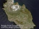
Small island with a lighthouse, Sri Lanka
February 18th, 2008 / / Links: Google Earth, Google Maps, Yahoo! Maps, Virtual Earth / Nearest placesShare This
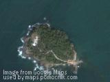
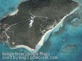
Small island with a lighthouse in Sri Lanka.
Send by:

 |
Shortcut » Newest places | Posts with videos | Selected places | Submit interesting place
Interesting places:


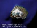
Small island with a lighthouse in Sri Lanka.
Send by:
Necker Island (Hawaiian: Mokumanamana) is a small island in the Pacific Ocean, 8 miles (13 km) north of the Tropic of Cancer. It is part of the Northwestern Hawaiian Islands, located 155 miles (249 km) northwest of Nihoa and 430 miles (690 km) northwest of Honolulu, and is part of the Hawaiian Islands National Wildlife Refuge within the Northwestern Hawaiian Islands National Monument.
The United States Census Bureau reports its land area as 182,890 square meters, or 45.193 acres. The island is rocky with steep sides and has very little soil. Its highest elevation is 277 feet (84 m).
Few signs of long-term human habitation have been found. However, the island contains 33 stone shrines and stone artifacts much like those found in the main Hawaiian Islands. Because of this, many anthropologists believe that the island was a ceremonial and religious site. According to the myths and legends of the people of Kauai, which lies to the southeast, Necker Island was the last known refuge for a race of mythical "little people" called the Menehune. According to the legend, the Menehune settled on Necker after being chased off Kaua'i by the stronger Polynesians and subsequently built the various stone structures there. Visits to the island are said to have started a few hundred years after the main Hawaiian Islands were inhabited, and ended a few hundred years before European contact. French explorer Jean-François de La Pérouse was the first European to visit the island, in 1786. The island is named after Jacques Necker.
Marion Island, the larger of the two islands, is located at. It is roughly 19 km (12 miles) long and 12 km (7 mi) wide with a surface of 290 km² (112 sq mi) and a coastline of some 72 km (45 mi), most of which are high cliffs. The highest point on Marion Island is Mascarin Peak (Formerly State President Swart Peak), reaching 1242 m (4,274 ft) above sea level. Boot Rock is about 150 meters (500 ft) off the northern coast.
Prince Edward Island is much smaller (only about 45 km², 17 sq mi) and lies some 12 nm (19 km) to the northeast. Prince Edward Island is located at [show location on an interactive map] 46°38′39″S, 37°56′36″E. At the Von Zinderen Bakker Peak northwest of the center, it reaches a height of 672 meters (2,204 ft). There are a few offshore rocks along the northern coast, like Ship Rock (100 meters, 330 ft, north of northernmost point) and Ross Rocks (500 meters, 1650 ft, from the shore).
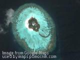
Thulhaagiri is one of the uninhabited islands of Kaafu Atoll.
[Source: ]
Send by: Qra
Eye of The Maldives.
Send by: Qra
Djerba (also transliterated as Jerba, Jarbah) is with its 514 km² the largest island off North Africa, located in the Gulf of Gabes off the coast of Tunisia.
The climate is mild and the soil well cultivated. Its largest city is Houmt-Souk, with a population of around 60,000.
Djerba is a popular tourist destination, particularly for French, German, Italian and Czech tourists. It is one of the few remaining places in Tunisia where a Berber language is still spoken. Another factor drawing some tourists to Djerba is the 1977 location of the Mos Eisley exterior scenes in the first Star Wars movie, filmed in the town of Ajim.
The beautiful island is noted as a center of the Islamic sect al-Ibadhiyah and is also noted for its Jewish minority, which has dwelled on the island for centuries, although populations have declined due to emigration to Israel and France since 1967. The El Ghriba synagogue is the oldest and one of the most famous in the world.
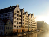
Granary Island in Gdańsk, Poland
Send by: genia
Isola di Vulcano (it) - The Volcano Island in Italy
Send by: Gfanhil
Leave a passing comment »