


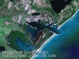
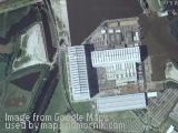
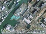
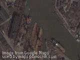
Rotterdam harbour, Netherlands
January 15th, 2008 / / Links: Google Earth, Google Maps, Yahoo! Maps, Virtual Earth / Nearest placesShare This
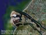
Rotterdam has the largest port in Europe, with the rivers Meuse and Rhine providing excellent access to the hinterland upstream reaching to Basel, Switzerland and into France. In 2003 Singapore took over, and in 2005 Shanghai, as the world's busiest port. In 2006, Rotterdam was the seventh largest port in the world in terms of containers (TEU) handled.
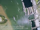
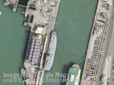
The port's main activities are petrochemical industries and general cargo handling and transshipment. The harbour functions as an important transit point for bulk materials and between the European continent and overseas. From Rotterdam goods are transported by ship, river barge, train or road. In 2007, the Betuweroute, a new fast freight railway from Rotterdam to Germany, has been completed.
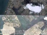
In 1872, the Nieuwe Waterweg ('New Waterway') opened, a ship canal constructed to keep the city and port of Rotterdam accessible to seafaring vessels as the natural Meuse-Rhine channels silted up. The canal proper measures approximately 6.5 kilometers (4 mi) from the western tips of its protruding dams to the Maeslantkering ('Maeslant Barrier'). Many maps, however, include the Scheur as part of the Nieuwe Waterweg, leading to a length of approximately 19.5 kilometers (12 mi).


Leave a passing comment »